129 years ago, the residents in the East End of London were still reeling from the last of the infamous Jack the Ripper murders and the climax of the Canonical Five murders – although, they didn’t know it at the time.
25-year-old Mary Kelly was found murdered on 9th November 1888 in Dorset Street, Spitalfields. Although there were a few murders after Mary Kelly’s, most Ripperologists believe that she was the Ripper’s final victim.
Let’s return to 1888 for a moment.
Following Mary Kelly’s murder, the people of the East End were in an uproar. Everyone was fearful of ending up as the Ripper’s next victim, and faith in the police force was taking a severe hit as detectives continually failed to catch Jack.
Morale was at an all-time low and fear was the flavour of the month in Whitechapel. The Ripper’s killing spree hadn’t gone unnoticed by people outside of the immediate area, either. As the national press caught on and knowledge of the murders gathered momentum, the Ripper found himself firmly ensconced in the public eye.
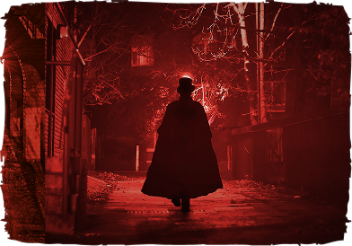
Being an infamous murderer meant that it must have become increasingly difficult for Jack to have successfully remained in hiding as more and more crimes were committed. However, judging by the fact that the Ripper murders are still unsolved and no culprit has been caught once and for all, he must have had a really good hiding place!
Although we don’t know where Jack the Ripper was hiding out during his reign of terror, as with everything surrounding the case, there is plenty of speculation about his choice of hiding position. Did the Ripper live a normal life by day, and commit murders by night? Did he hide out in his home, unsuspected by friends and neighbours? Did he call the streets his home? Was he constantly on the move, going from one hiding place to another in an attempt to avoid detection?
These are all questions that we are likely never to get a solid answer to, but we can use a Jack the Ripper map to mark out some of the most likely possibilities for his hiding locations.
From the location of the murders, it is highly likely that the Ripper was a resident of the East End, possibly even within Whitechapel itself. Living close to the scenes of the murders would have had a distinct advantage as he would have known the area well, allowing him to make a quick getaway. He would also have known the whereabouts and regular habits of the other residents of the area, making them easy targets without them even realising.
Staying Close to Home?
So if he wasn’t hiding out in his home, where else could he have been staying? Is it possible that the Ripper was renting a room in the Ten Bells pub, one of the most infamous locations on the Jack the Ripper map? The pub would have been the perfect location for the Ripper to plan his crime spree from, especially given its centralised location to the murder scenes.
One other suggestion that has been banded around is that of the Ripper living rough and sleeping on the streets. It’s possible that he could have dropped out of society and spent his days among the countless unfortunates who called the streets of London their home at the time. He would have been constantly on the move, both in an attempt to evade the police and to avoid ending up in a Victorian workhouse.
To trace the Ripper’s likely hideouts yourself and see the map come to life on the streets, book a walking tour through Whitechapel.
What do you think is the most likely solution? Get to know the locations on the Jack the Ripper map for yourself by joining in one of our walking tours. For more information or to book your place on a tour, give us a call on 078 0306 7544.
88 Whitechapel High Street, London, London Borough of Tower Hamlets E1 7QX, United Kingdom

Disclaimer: The Jack the Ripper Tour contains graphic descriptions, stories and images that some people may find upsetting. Parental guidance is advised.
7:30pm
5:00pm & 7:30pm
1hr 45mins
Outside the Whitechapel Art gallery
Exit 3 of Aldgate East Station
or call
07803067544")